
This was our last loaded training ride planned. We’ve still got two weekends before starting the tour, but next week is Tierra Bella, and we don’t need to be too crazy looking for an organized ride. Ruth has been asking to do a ride with her on her own bike, like we did in Davis. So we were thinking of doing that for the final weekend.
It was rainy yesterday. We would have done the ride regardless, but we didn’t need more rain training. I was happy to see that as forecast, it cleared out, leaving us with perfect biking weather. Mid-60s, and partly cloudy. Warm enough to not need to suit up, cool enough to not sweat too much, and not always baking in the sun.
This was another ride that took us across the Bay into the hills on the Peninsula. Just before the top of Dumbarton Bridge, I heard a grinding coming from Ruth’s trailer. I stopped to investigate, and I guess between the grinding, asking Ruth if she knew where it was coming from, the wind, and noise from the traffic (even with a concrete barrier, oncoming traffic at 65 mph four feet away is intimidating), Ruth got pretty upset. While I comforted her, Anne arrived and quickly determined that the flag post had slipped and was dragging. I wedged it back into place, promised Ruth some food after the bridge, and got going. By the time we got to the benches at the bottom, she was back in good spirits.
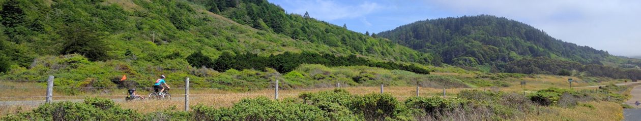
We rode across the Peninsula and to Sand Hill Road. As we passed the Stanford Mall, we saw some kind of biking event was in progress. There was a course fenced off in the parking lot, and a bunch of banners for ebikes. We kept going, and started to climb. There were quite a few other bikers. The volume really picked up after crossing 280, when we were passed by a steady stream. We cut over on Manzanita Rd, a much quieter single-lane road, which eventually turns into the the larger Cañada Rd. We came along the far side of some of the foothills, gaining elevation as we went.
Then it was time for the real climb up to the Redwood City Cross. We considered whether we should stop for lunch now or later. We weren’t quite sure how long the climb was going to be. We decided to have a quick snack and try to keep the momentum going and get the climb done. As we continued, the grade picked up. Mostly it was still pretty manageable, although there were some short steep bits. Anne deftly led us through the twisty roads, when I first saw the cross. I had assumed it was referring to a road crossing, but it’s actually a giant white crucifix. We could only catch glimpses of it between trees as we approached.
Waiting to eat ended up being the right choice, as it only took about 30 minutes to get the summit. You can barely see the cross from the top, either, as it hides behind a water tower and some other utility equipment. We stopped to eat in a short gravel section that connects the road on either side of the hill. It was pretty quiet while we were there, but there was lots of unfortunate evidence of others – food wrappers, many many beer bottle tops, and even some socks.
Ruth declared that we needed to put rocks on the blankets to keep the wind from blowing them away, so she and Max spent considerable time lining the blankets with little rocks from the gravel. It wouldn’t have stopped anything, but, hey, cheap entertainment is good entertainment.
After lunch we were ready for a descent down the other side of the hill back towards home. It was overall downhill, but had lots of short uphills. And the downs tended to have short sight lines, so we had to keep the speed down too much to really fun. It was still nice to get some rollers in.
The return featured a lot of familiar road, but Anne had picked out a different approach for getting across 101 and to the bridge. It turns out there’s a footbridge across 101 a bit north/west of Willow. It featured right turns on both ends of the crossing, but there weren’t any other users so we could just take them wide with the trailers. It’s nicer than the hairpins on the Stevens Creek Trail overpasses.
We stopped for a final snack, then headed north towards the the bridge. The route took us kind of behind Facebook’s new campus, where we could see what looked like a new bike boulevard almost completed. It’ll probably be nice when it’s done, but right now it just means no shoulder on the road. We got to Marsh Raod, navigated the bike path that switches sides of the six lane road, hopped across Dumbarton and back home.
For the second ride in a row, we were actually able to complete the ride at a reasonable hour. It’s almost like we’re actually going to be ready for the tour.