Day Three: Crescent Lake to Elk Lake

Today’s ride was moderate in distance and climbing. The challenge came from being the third day in a row, and weather.

As we got started, the temperature was hovering around 40 and overcast. This is colder than we’ve trained in, though I’ve had some experience commuting. We layered up (including Max with his pajamas under his bike clothes) and prepared to go.

We didn’t sort out lunch last night, so we biked across the street to the market. Anne went in and ended up finding some breakfast sandwiches we could stash.

Nearly the entire day was on the Cascade Lakes scenic byway. This cut through the forest with only light traffic. We rode past rivers and lakes, with mountains in the background.

It never really got warmer. It sprinkled a tiny bit from time to time, but not enough to really matter. We put up the green torpedo on the trailer to help keep Max warm. Ruth was jealous.

We had a number of small climbs, with descents to break it up (and get cold).

Lunch was at a pullout, and cold. Since we stopped moving, we put on more layers to try to stay warm. The kids seemed snug, but I was cold.

The sun came out for a while later in the day, which helped. Max got a turn on the tandem, letting Ruth enjoy the green torpedo.

We arrived at the Elk Lake Resort with just enough time to shove everything in the cabin and take quick showers to get to the restaurant before last call. Eating in the room wasn’t appealing, nor was eating outside (have I mentioned it’s cold?). So we ate in the restaurant. It’s the first time any of us has done so in 15 months. We are truly exciting people.

I’m looking forward to our rest day tomorrow. It’ll probably be too cold to do anything on the lake. But just hanging out and giving our bodies a break sounds pretty good.

Day Two: Oakridge to Crescent Lake

Yesterday’s ride was hard because it was long. Today’s was hard because it had a lot of climbing. We spent the whole day on Hwy 58, climbing up to the 5128 foot Willamette Pass.

The last twenty miles yesterday were also on 58. Today the shoulder was mostly decent. Traffic today was much lighter than yesterday, and we had a passing lane in our direction most of the day, so vehicles could give us room.

The climb started pretty mild, in the 4% range. The second half kicked it up to 6-7%, still not too bad, but tiring as it continued for miles and miles.

While we were stopped for a snack, a state trooper stopped to check on us. He asked about our plans, and warned about the tunnel coming up and generally about the road. The road certainly wasn’t ideal for cycling, but sometimes that’s the only way through.

Just as we approached the tunnel, my leg started cramping. We knew we needed to be as fast as we could through the tunnel, and certainly couldn’t stop. I walked around to stretch my leg while Anne scouted the shoulder in the tunnel. It was filled with the same gravel that was at the edge of most of the road. Even if it hadn’t been narrow, we would have no choice but to take the lane, no easy feat in 55mph traffic while climbing.

I declared my leg good enough, lights were set to maximize visibility, so it was time to go. Ruth pressed the “bikes in tunnel” button, we waited a moment for a break in traffic and headed in. I led with Max, with Anne and Ruth behind. Tunnels are intimidating, with no room to maneuver. An RV came in behind, and thankfully stayed back without trying to go around. That solved the safety issue, though it’s still intimidating. I pushed a little too hard to go fast, but after half a mile we were through and back in the shoulder.

We stopped at Salt Creek Falls, a 286 foot waterfall. The kids enjoyed running around off the bikes for a few minutes.

It was still a few miles to the summit. As we got closer I called for more and more pauses in turnouts. They were quick, but added up. Finally we made it to the top. We took some pictures, put on more clothes so we wouldn’t freeze on the brief descent, switched the trailer to Anne, and continued.

It would have been smart to switch to fingered gloves, but otherwise the descent was smooth and straight. We only gave back a little elevation, the rest we get to enjoy in a few days.

Then it was a few mostly straight miles along Odell Lake then over to Crescent Lake and our hotel. Last time those miles felt like forever, but today it wasn’t too bad.

The hotel room is nice and big, with plenty of room for our gear. There’s even a proper dining table, which made takeout dinner much nicer.

Across the street is a collection of crashed semi trucks and trailers. Maybe the trooper was right that there are a lot of crashes on the highway..

Tomorrow should be much quieter as we head to Elk Lake and then our first rest day is the trip.

Anne would like me to note several exciting roadside sightings: bottles containing liquids other than what it says on the label, an assortment of boxers, and at least five wrenches.

Day One: Rainbow to Oakridge

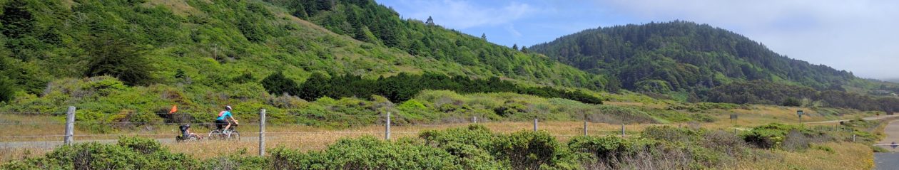
Our 2021 tour has official begun. We had two fully planned and booked tours cancelled over the last two years (2019 due to a cracked bike frame, 2020 due to covid). Anne, the master planner, didn’t want to lose all that work again. So we decided to mostly repeat the 2013 Oregon Cascades tour we did. The days would be the same, so it takes much less planning.

At least that was the idea. Road closures defeated those plans. Contingencies were designed, alternate routes identified. Fortunately all but one road is now passable. Today’s road.

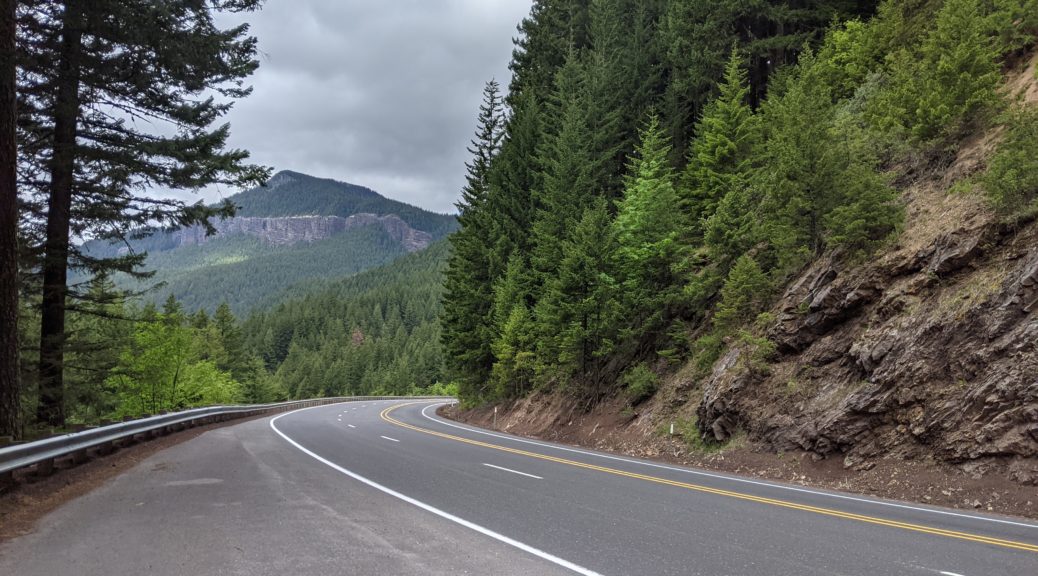
Aufderheide is a beautiful road up through Willamette National Forest. At least it is, when it isn’t closed by a rock slide. The original closure order expired today, so we were hopeful it might be cleaned up. Yesterday a new closure was issued, this time until October.

We had explored various alternates. There are other roads through the forest, but they’re unmaintained and with unknown snow, downed trees, washouts, rock slides, etc. For a while we were thinking we’d spend our first “tour” day shuttling between cities to drive the bikes to Oakridge, then leaving the van back in Rainbow for our return, with varying rental cars, public transit, and taxis getting people back to Oakridge.

In the end, we decided to just bike it. We’d have to bike most of the way back west to Eugene before turning back southeast. It made for a long day on less awesome roads, but at least we were biking.

We started west on Hwy 126, which we had seen on the way to Rainbow had between nice and non-existent shoulders. But traffic was fairly light to start. The area is starting to recover from the McKenzie/Holiday Farm fire that started last September. The signs of the fire were everywhere. Hillsides of naked burned tree trucks. Empty foundations, maybe with a brick fireplace still standing. A few burnt out cars and boats.

The signs of recovery were also there. Trees being cleared. New house construction. Restoration of roadways, with new guard rails. Crews clearing burnt trees and loading them on logging trucks. A few hillsides were filled with stumps and covered with a thick layer of sawdust.

We were stopped by a few flaggers where crews were working, including one with a guy hanging from a crane to cut down a tree. This bunched up what little traffic there was, giving us nice car-free stretches for miles after.

As usual when biking on roads I’ve driven on, there were lots of new details invisible from the car. We passed waterfalls, river vistas, and a bridge foundation with no decking (maybe it had a wooden structure lost in the fire).

126 was the first 40 miles of the day, mostly downhill. The second half had traffic pick up, either as it got later or just closer to Eugene. The weather started cool and overcast, but warmed up and the clouds burned off. Just at the end, as we entered the more suburban Springfield, there were a pair of short hills to test our legs.

Then we got onto Weyerhauser, a multiuse trail that seemed to be a former road, maybe supporting the natural gas pipeline that seemed to be buried under it. It had a short but moderately steep climb. Anne (with both kids) decided to walk for a while, but I made it up. While I waited I chatted with a local cyclist (one of the few seen today). He gave some tips on local roads, including options for our afternoon.

When Anne arrived we decided it was time for lunch. Usually my goal is to get 20 miles behind us before breaking for lunch. Today we got over 40. Downhills help.

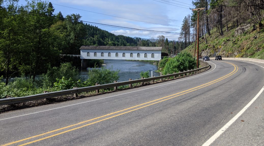
After finishing the trail (including a gate narrow enough we had to lift the trailer over it) we had about ten miles of nice shoulder and light traffic before crossing the bridge in Lowell to get to Hwy 58, where we’ll be spending all of tomorrow.

58 is busy with heavy truck and car traffic, mostly one lane in each direction, and without much shoulder for most of it. Our memory of tomorrow’s section is plenty of shoulder, but that definitely wasn’t true for today’s road.

We had an alternate, quieter road option, but it would have added more distance and climbing to an already long day. It also had something like 12 miles of gravel, which isn’t much fun for us.

The most substantial climb of the day took us up to the top of a dam. Once there, the road was mostly flat, with some slight downhill segments to make us feel fast and a tailwind to boot.

But even with those advantages, the day’s miles were taking their toll. The last twenty miles ticks down as pain in my feet grew. The road shifted to a slight uphill, which didn’t help.

But then we were in Oakridge. Our hotel is on the far side of town, with more uphill. But we made it, and packed everything into the room.

We found dinner and groceries for tomorrow. Now we just need to get everybody to sleep. Max has too much energy; he must not have pedaled enough.

I’m glad we decided to bike it today. Tomorrow will be another long day, though this time due to one giant climb instead of distance.