
Anne’s bike computer ate another route, but with the help of the Adventure Cycling paper maps we found our way through the mostly flat path to Ferndale.
As we went to check out this morning, some of the proprietors, a pair of sisters with five kids under age 8 between them), were very curious about our adventure. One had done the coast, ending in Trinidad, before kids. We answered their questions (would you recommend it? Umm.. It’s not for everyone…). As we were getting going, I could hear them plotting how they could make it happen.
That’s when we discovered that Anne’s GPS had eaten another route. I suspect it’s getting full and deleting things willy nilly, but I neglected to pack the cable which would let us offload recorded rides onto a phone. Last time it happened, we were just following 101 all day. This time had a more complicated route snaking through Arcata and Eureka. So we broke out the Adventure Cycling map (where our planned route came from) and Anne got to actually use the map holder feature of her handlebar bag.
We took the Trinidad Scenic Drive to get out of town. There was a sign warning away trucks with trailers. They weren’t kidding. The road wound along the cliffs, offering great views hidden behind the fog. In parts it was single lane. In large parts the road had washed away, leaving only gravel. For most of it, even when there was pavement, it was heavily patched and extremely uneven.
With a quick jaunt on 101 in freeway mode to connect, we next took the Hammond Coastal Trail. This is a hike/bike/horsey time path cutting through McKinleyville. For most of it was nicely paved, but there was a gravel climb section which we had to walk.
We stopped for an early lunch at Hiller Park. We’ve been trying to get at least 20 miles done before stopping. Otherwise the afternoon stretches on forever. When a playground appeared at mile 12, we knew we would need to stop. The kids are putting up with a lot. Naturally, the first thing they played with was a bouncy car on a spring. Basically, the playground equivalent of a bike trailer.
We continued south across an old rail bridge turned to graffiti laden path, then along Mad River. To the left, wooded hills. To the right, ocean with a wall of fog. In the middle, a five mile strip of farmland, mostly pasture for cows.
We rode through a pretty happening downtown Arcata, then 101 again towards Eureka. We ran parallel to an abandoned rail line. At least one bridge had lost all of its supports, leaving floating rail with ties. We could see the other side of the bay to the west, shrouded in fog like we were hitting the draw distance of an underpowered video game. The shoulder was dyed red, presumably as part of the safety corridor that was excitedly signed. Once in Eureka, we took city streets around the waterfront, rejoining 101 at the south end of town.
We got off at Tompkins Hill Road (not actually a hill as far as I could tell) and passed the College of the Redwoods, which seemed to be served by a ridiculous number of buses. Then to Eel River for the closest thing to a climb for today. It was still work to get up and over.
We crossed what I believe to be the oldest bridge on the trip so far, Fernbridge, opened in 1911. The final few miles on CA 211 took us through more pasture, featuring oversized wooden cutouts of idealized farmers caring for calves and hauling hay.
Ferndale is an old town in remarkably good condition. There are many examples of Victorian architecture and a nice downtown strip. Our hotel, the four room (so tied for smallest) Francis Creek Inn, is for sale. There’s even a sales flyer in the room. If you want to own a small hotel and store in Ferndale, look them up.
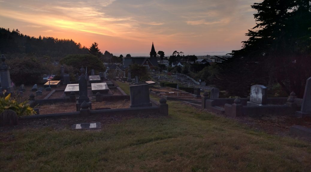
After dinner and groceries, we took our customary walk to stretch out and let the kids burn off energy. Based on a tip from the innkeep, we found the Ferndale Cemetery. It’s built on a hill and features burials back to 1877. Climbing the hill gives an excellent view of the town.